


290 Maryam Springs 260,
Courbevoie, Paris, France
Interior design is the art and science of enhancing the interiors.
Geodetic, Aerial, and Inspection Expertise—Trusted Across the Philippines.
Sebastian Surveying Services is a full-service geodetic and aerial survey firm providing accurate, technology-driven mapping and inspection solutions. From boundary verification to large-scale LiDAR mapping and technical consulting, our licensed team delivers data you can build on—backed by commitment you can trust.
Sebastian Surveying Services was established on the belief that dependable data drives successful development. With a focus on precision, we offer expert-led surveying and geospatial solutions for landowners, developers, engineers, and institutions. Whether it’s a simple lot verification or a multi-hectare LiDAR project, our team is committed to delivering clarity through every contour, line, and coordinate.
We offer a complete suite of Geospatial Data products and Geodetic Engineering services.
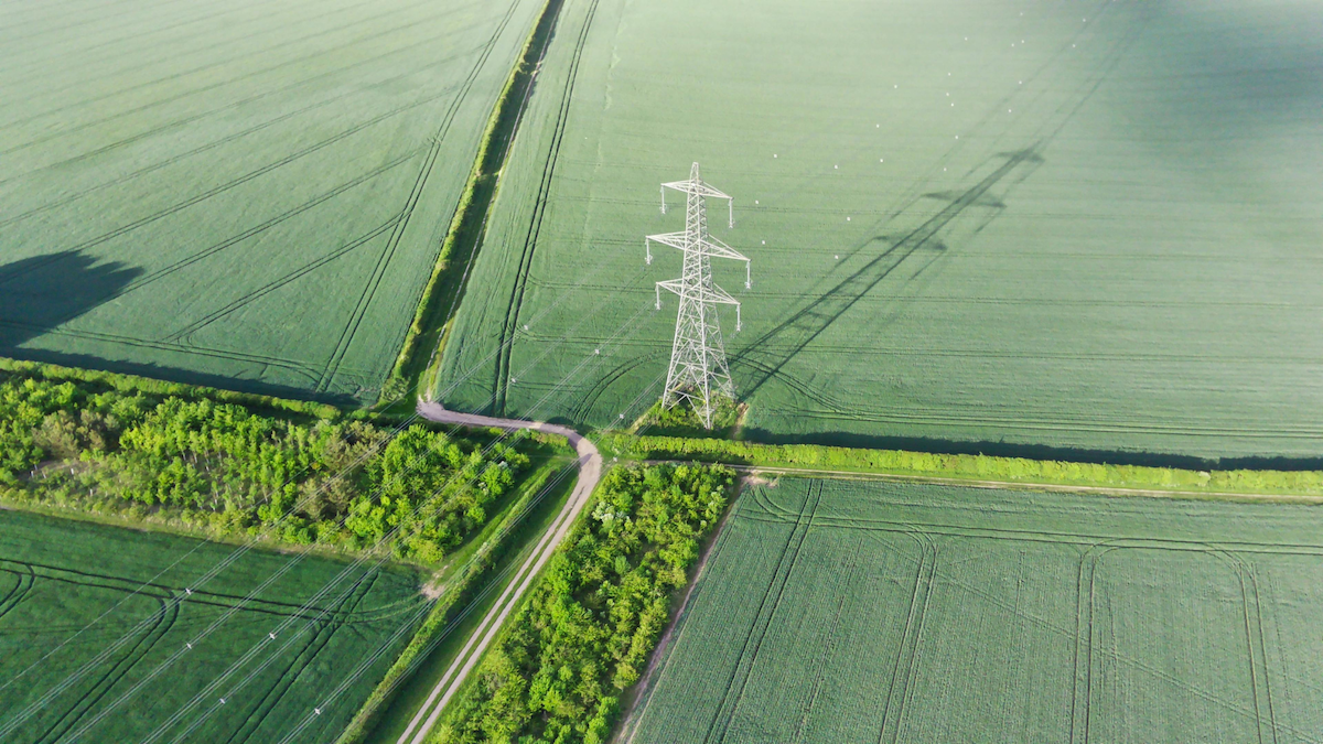
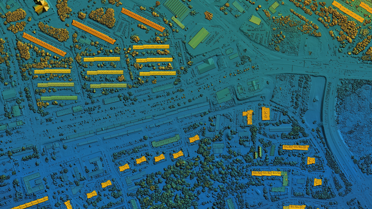
An aerial survey is the process of gathering information and imagery from the air, using platforms like airplanes, helicopters, drones, or satellites. It’s a method of collecting geospatial data from an overhead perspective to map and analyze the Earth’s surface and the objects on it.
General UAV Visual Inspection: Provide visual documentation for assets, utilities, or infrastructure audits.
A land survey is the process of measuring and mapping a piece of land. It precisely defines the boundaries, dimensions, and features of a property.
Lot Plan & Vicinity Map Preparation: Generate updated technical plans and vicinity maps required for permits and title-related documents.
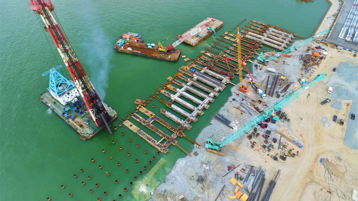
Engineering surveys are a specialized type of surveying that focuses on the specific needs of engineering projects. They provide the precise measurements and spatial data necessary for the planning, design, and construction of everything from roads and bridges to buildings and utility lines.
Be it for your dream house, construction of roads, planning for energy-related facilities, or developing a sustainable farm, we provide rich and accurate geospatial data for better decision-making, smarter planning, and improved design.
A GPS survey uses signals from the Global Navigation Satellite System (GNSS) to determine precise locations on Earth. Unlike traditional surveying methods that rely on measuring angles and distances between points on the ground, a GPS survey calculates positions by triangulating signals from a network of orbiting satellites. This technology has revolutionized the surveying industry by significantly increasing efficiency and enabling accurate measurements over large and difficult-to-access areas.
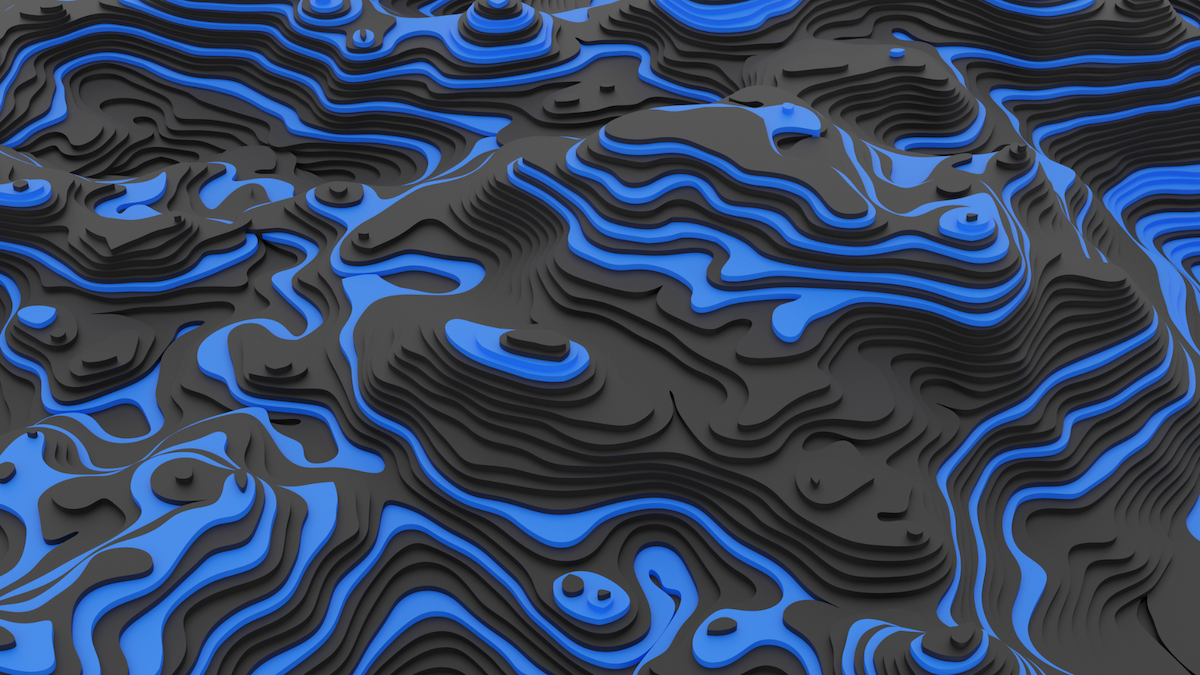
Geotechnical investigation is the process of exploring and evaluating the subsurface conditions of a site to understand the properties of the soil and rock. It’s a critical first step in any major construction project, as it provides essential data for designing safe, stable, and cost-effective foundations. Soil testing is a fundamental component of this investigation, involving a series of procedures to determine the physical and engineering characteristics of the soil.
Survey consultation services provide expert guidance and management for all types of survey projects. A survey consultant acts as a strategic advisor, leveraging specialized knowledge to ensure that a survey—whether it’s for land, construction, or research—is planned correctly, executed efficiently, and yields accurate, reliable data.
Whether you need a boundary confirmed, a drone inspection, or a full-scale survey package, we’re here to help. Get in touch for a no-pressure consultation and an honest, detailed quotation from our team.
Through a unique combination of engineering, construction and design disciplines and expertise, Concor delivers world class infrastructure solutions to customers and stakeholders across a broad range of industry sectors.
Through a unique combination of engineering, construction and design disciplines and expertise, Concor delivers world class infrastructure solutions to customers and stakeholders across a broad range of industry sectors.
By starting with a comprehensive assessment of your requirements, you’ll be provided with a project proposal based on appropriate methods and technologies. Upon turnover of the project deliverables, our after-sales support and project managers ensure you make the most out of your precious datasets.
Lorem ipsum dolor sit amet, consectetur adipiscing elit, sed do eiusmod tempor incididunt ut labore et dolore magna aliqua. Ut enim ad minim veniam, quis nostrud exercitation ullamco laboris nisi ut aliquip ex ea commodo consequat. Duis aute irure dolor in reprehenderit in voluptate velit esse cillum dolore eu fugiat nulla pariatur.
Lorem ipsum dolor sit amet, consectetur adipiscing elit, sed do eiusmod tempor incididunt ut labore et dolore magna aliqua. Ut enim ad minim veniam, quis nostrud exercitation ullamco laboris nisi ut aliquip ex ea commodo consequat. Duis aute irure dolor in reprehenderit in voluptate velit esse cillum dolore eu fugiat nulla pariatur.
Lorem ipsum dolor sit amet, consectetur adipiscing elit, sed do eiusmod tempor incididunt ut labore et dolore magna aliqua. Ut enim ad minim veniam, quis nostrud exercitation ullamco laboris nisi ut aliquip ex ea commodo consequat. Duis aute irure dolor in reprehenderit in voluptate velit esse cillum dolore eu fugiat nulla pariatur.
Adding {{itemName}} to cart
Added {{itemName}} to cart